Best Hikes in Zion National Park
Zion National Park encompasses 232 square miles of pure awesomeness. The red rock wonderland boasts narrow sandstone canyons, soaring red cliffs, and pockets of lush vegetation that burst with life.
From its intoxicating blend of brilliant colors to its serpentine canyons flanked with sheer walls, the Utah park brims with bucket-list backdrops and incredible hiking opportunities.
I first visited Zion when I was fourteen. I remember standing in awe of the park’s towering rock walls and saturated color scheme.
Three visits and sixteen years later, the park has not ceased to leave me awestruck.
THINGS TO DO IN ZION NATIONAL PARK
Zion is often regarded as one of the best national parks in the United States.
Even in Utah—a state that showcases some of nature’s most incredible feats—it still finds a way to stand out.
In Zion, the Colorado Plateau, Great Basin, and Mojave Desert all converge to create a landscape of geologic wonders. As with California’s Joshua Tree National Park, the convergence zone results in an ecosystem that is wholly unique. Its mesas and canyons have been sculpted over millennia by wind, rain, ice, volcanic activity, and the flow of the mighty Virgin River.
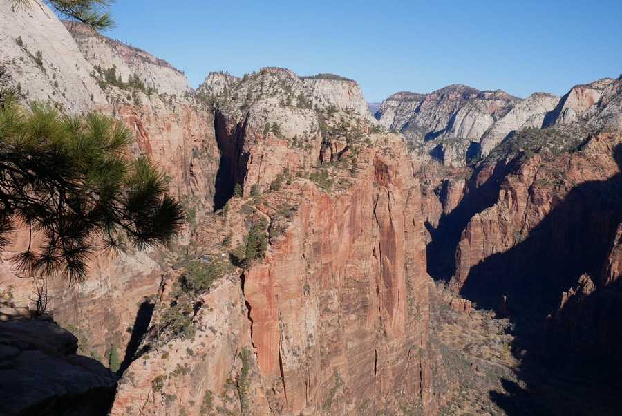
For travelers with limited time, cramming all of Zion’s top hikes and attractions into an itinerary can be intimidating. The national park is simply teeming with things to see and do.
ZION CANYON HIKES
Zion Canyon is the national park’s beating heart. It is home to iconic hiking trails that afford striking views of the area’s fiery red rock walls. The canyon’s cliffs and meandering river provide some of the most well-loved backdrops in the United States.
Tourists flock to Zion Canyon’s spectacular viewpoints and hikes. They clog the trails, swarm the shuttle stops, and file up hiking trails like a colonies of ants.
Still, the red rock canyon is one of the grandest areas of Utah’s Mighty 5 and a must-visit bucket list destination for nature-lovers.
-
THE WATCHMAN TRAIL
Located near the Zion Canyon turnoff, the three mile Watchman Trail affords spectacular views of the canyon cliffs.
The trail leaves from near the the park’s South Entrance and is one of Zion’s most accessible hiking destinations.
For travelers who wish to avoid shuttle lines, it is a fantastic option.
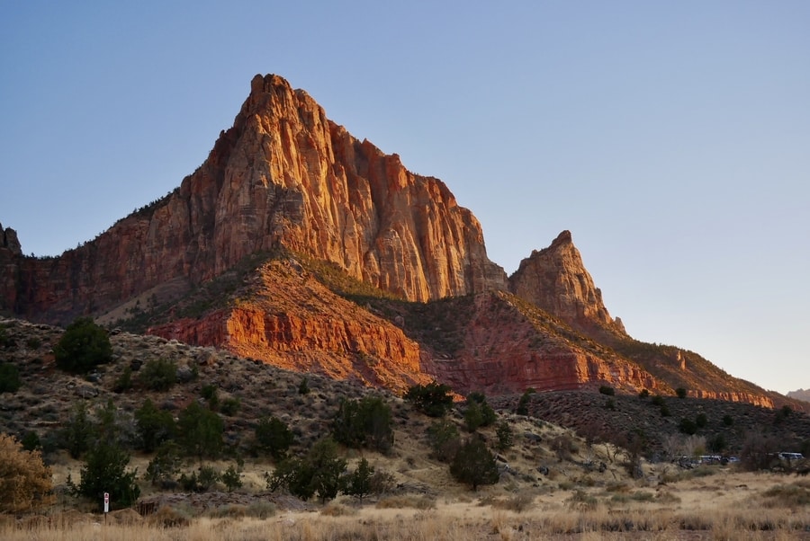
Since Dan and I set out to hike the Watchman as the sun was setting, we didn’t make it to the top of the hike by the time it got dark.
But the views along the way up were spectacular nonetheless. They rivaled some of the more well-known vistas that lie in the heart of the park.
-
EMERALD POOLS TRAIL
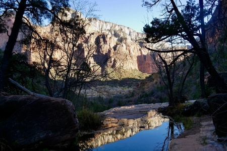
While Zion is most often associated with reds and oranges, the park has pockets of green that stand in stark contrast to their fiery surroundings. At the Emerald Pools, a series of desert oases conceal jewel-like ponds, lush vegetation, and weepy waterfalls.
The Emerald Pools Trail consists of a series of short loops that meander past lushly-vegetated streams. The three-mile combination hike to the upper and lower pools is fairly level and easy—making it a great destination for kids and those seeking a gentler stroll.
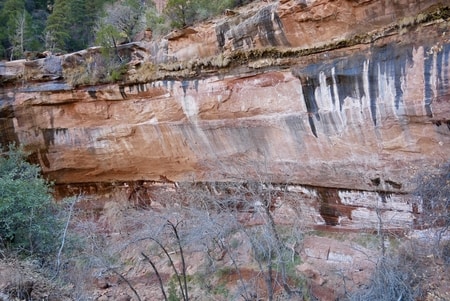
When Dan and I visited the Emerald Pools, we found the area to be mostly dry. A light wisp of water trickled off the area’s black-and-white-stained cliffs, but it was nothing like the photos I’d seen online.
While still beautiful, I imagine the Emerald Pools Trail is likely best in times of year when water is present.
-
ANGEL’S LANDING
Angels Landing is a 5.4-mile round-trip hike that spends its last half-mile snaking up a precipitous sandstone fin. It is the most iconic hike in Zion. The trail begins by ascending a series of zigzagging switchbacks. After reaching Scout’s Landing, its course becomes increasingly precarious.
For its last half-mile, chains provide a lifeline up the mountain. Along either side of the trail, the red sandstone plummets to the valley floor.
On previous trips to Zion, I didn’t have the guts to hike the Angel’s Landing trail. As someone who is marginally afraid of heights, the videos and images I’d seen of its precarious drop-offs made my feet practically go numb.
But on my most recent visit to the park, I figured I should at least give the trail a try. If I didn’t feel comfortable moving forward, I could always turn back, I told myself.
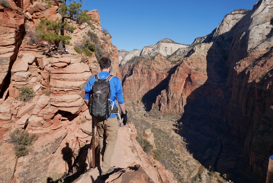
It turns out that the hike up Angel’s Landing wasn’t nearly as treacherous as I’d expected. And the payoff was certainly worth the moments of trepidation.
That being said, the hike is certainly not for everyone. Always remember that if the trail is too much, there is no shame in turning back. There are plenty of other viewpoints in the park that afford similarly striking vistas.
-
OBSERVATION POINT
Though Angel’s Landing is Zion National Park’s signature hike, I’d argue that Observation Point actually has the better views. The hike is longer, higher, and less crowded.
For those who wish to skip the adrenaline rush, Observation Point offers a less heady alternative with incredible views downcanyon. It winds up a steep trail that boasts photo opportunities at every bend.
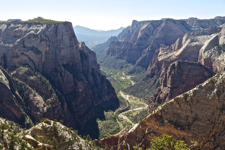
From the top of Observation Point, a tapestry of greens, oranges, reds and pinks unfolds. The aerial view showcases vegetation-speckled cliffs, the sinuous spine of Angel’s Landing, and the winding course of the Virgin River.
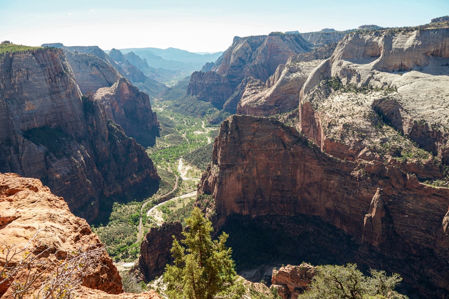
The eight-mile round-trip trail up to Observation Point is accessible via the East Rim Trail, from Weeping Rock (currently closed due to rockslides).
-
THE RIVERSIDE WALK
The two-mile Riverside Walk makes up the first portion of the Zion Narrows.
An easy stroll, it affords views of narrowing sandstone cliffs and the ambling Virgin River. Cottonwood trees cover the majority of the path throughout the day, creating a comfortable shade and adding to the area’s explosion of color.
Wildlife abounds along the Riverside Walk. During our visit, we saw mule deer, squirrels, and a variety of birds.
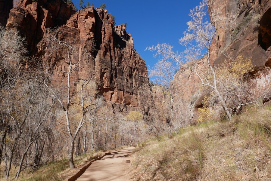
Much like a neighborhood sidewalk, the gentle path is level and paved.
At the end of the path, hikers can peer into the iconic Zion Narrows.
-
THE ZION CANYON NARROWS
The Zion Narrows Hike is one of the national park’s primary draws. The hike begins at the end of the Riverside Walk. It follows the course of the Virgin River and requires wading through ice-cold water.
Many casual hikers—outfitted with sturdy shoes, trekking poles, and drysuits—wander in for a look and turn back after a few hours. To complete the entire hike requires following the river for 16 miles, from the end of the Riverside Walk to Chamberlain’s Ranch (or vice-versa).
Journeying past Big Springs requires a permit.
I didn’t get the chance to hike the Zion Narrows on my most recent visit due to toxic algae bloom in the Virgin River, but fondly remember exploring the area during a school trip in 8th grade.
KOLOB CANYONS IN ZION NATIONAL PARK
Zion’s main canyon is spectacular. It features some of the most iconic scenery in the United States.
But there is so much more to the seductive red-rock area than most visitors even realize. So when camera-toting tourists swarm the trails in Zion’s main canyon, hikers seeking more solitude head to the Kolob Canyons instead.
The Kolob Canyons section of Zion sees only a fraction of the park’s visitors. A Sedona-like landscape of colorful geology, the area showcases a series of parallel fissures that glow a fiery red.
These fissures, or ‘finger canyons,’ conceal lesser-known hiking trails that lead to oases, natural arches, and unique sandstone formations.
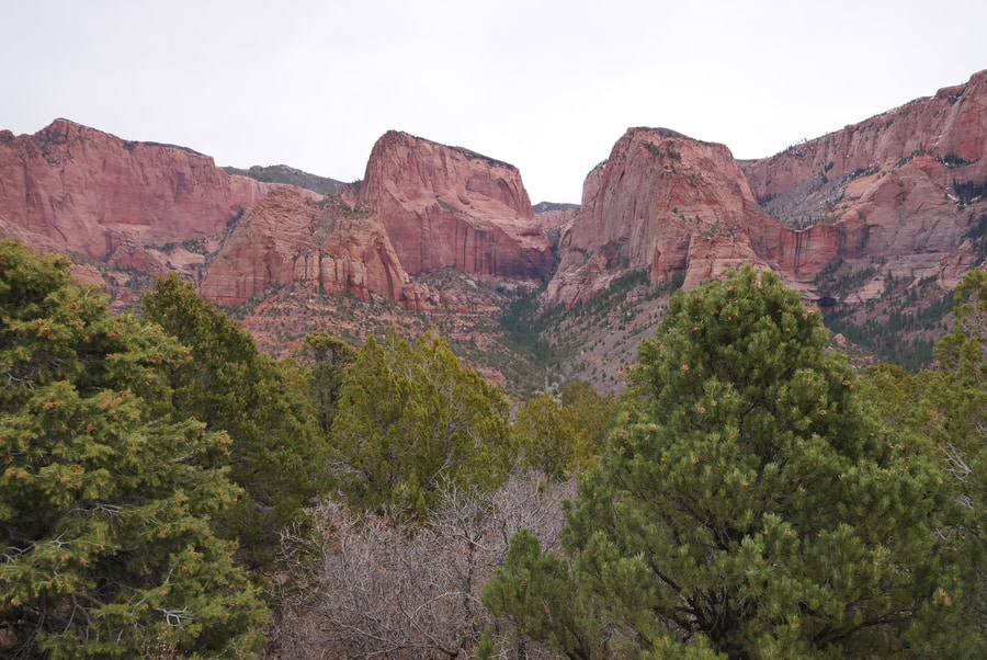
Kolob Canyons Road is a scenic drive that offers a glimpse into the finger canyons. The road ends high up on a ridge, at Kolob Canyons Viewpoint.
-
TIMBER CREEK TRAIL
Timber Creek Trail, the easiest path in Kolob Canyons, lies at the end of the road. The scenic 0.5 mile trail follows a 100ft ascent to a small peak. It affords sweeping views from the top of the ridgeline and offers travelers with limited time an opportunity to experience the area’s beauty.
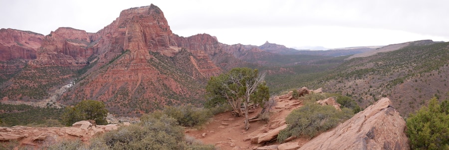
On clear days, it is possible to see all the way to the northern lip of Arizona’s Grand Canyon.
-
TAYLOR CREEK
Taylor Creek’s Middle Fork is the most popular hike in Zion’s Kolob Canyons. A five mile hike up one of the area’s enchanting finger canyons, it boasts views of historical cabins and the Double Arch Alcove.
While at the national park’s main visitor center, I overheard a staff member recommend the Taylor Creek hike to a customer. She mentioned that it was, without a doubt, her favorite trail in Zion National Park.
I didn’t have the chance to hike along Taylor Creek during my visit to Kolob Canyons. If I’d had more time, however, the hike would have been a top priority.
THE ZION-MOUNT CARMEL HIGHWAY
Some Utah parks (notably Arches and Bryce) offer travelers an opportunity to drive from viewpoint to viewpoint.
But Zion National Park isn’t that type of place. In fact, Zion caters almost exclusively to hikers.
The Zion-Mount Carmel Highway is a notable exception.
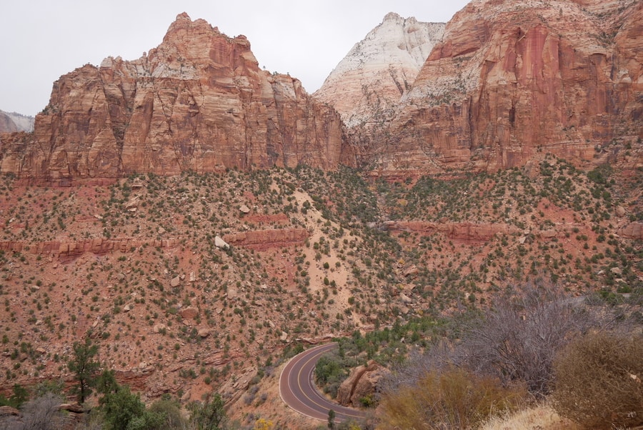
The ribbon of pavement carves through sandstone and affords views of some of Zion’s most beautiful natural features. It begins near Springdale and climbs up a canyon wall in a series of switchbacks. Two tunnels—illuminated by windows that cut through to the cliff face—slice through the deep stone mountains.
While primarily a thoroughfare with scenic vistas, the Zion-Mount Carmel Road is also home to one of the national park’s most scenic hiking trails.
-
CANYON OVERLOOK TRAIL
The one-mile Zion Canyon Overlook Trail is a short and relatively easy hike.
But the short trail packs a lot of punch when it comes to views.
The overlook’s tremendous viewpoint reveals the Zion-Mount Carmel Highway’s zigzagging switchbacks.
Beyond, views unfold over the West Temple, the Towers of the Virgins, and the East Temple.
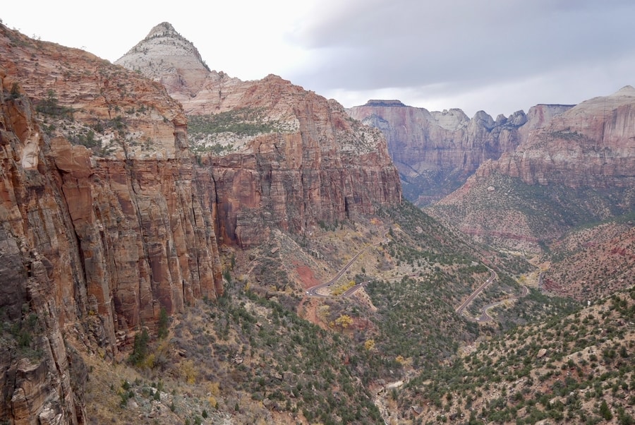
For those with limited time, the short overlook hike offers views comparable to those of Angel’s Landing and Observation Point.
ADDITIONAL HIKES IN ZION NATIONAL PARK
Zion is a hiker’s wonderland. As with the Canyonlands Needles, it isn’t the type of place that can be fully appreciated from behind the window of a moving car. While it is possible to get a taste for the area’s diverse offerings over the course of a few days, it would take weeks to experience all of Zion’s top hikes. I certainly have not had the time to undertake them all.
On my next visit to Zion, I would like to prioritize the Subway and the West Rim Trail.
-
THE SUBWAY
The Subway is a semi-technical slot canyon hike in Zion National Park. Completing the hike requires wading and scrambling down the Left Fork of North Creek.
I’ve heard the Subway described as a more challenging version of the Narrows. It requires a permit and a shuttle.
-
WEST RIM TRAIL
The West Rim Trail is Zion’s premier backpacking destination. A 28 mile journey (14 miles one-way), it starts at Lava Point and descends into Zion’s main canyon. Though it is possible to rush the entire length of the route in one day, most visitors make it a two-day trip by camping either at Potato Hollow or Cabin Springs.
There are a total of 9 campsites on the West Rim Trail. A permit is required to camp within the park.
WHERE TO STAY NEAR ZION NATIONAL PARK
Zion National Park is home to two established campgrounds and a historic lodge. Zion Lodge lies near the Emerald Pools Trailhead, about halfway down the Zion Canyon.
For travelers looking to have a more rustic experience, the South Campground and Watchman Campground (each $20), have more than 300 combined camping spots. They lie on either side of the visitor center, near the main entrance.
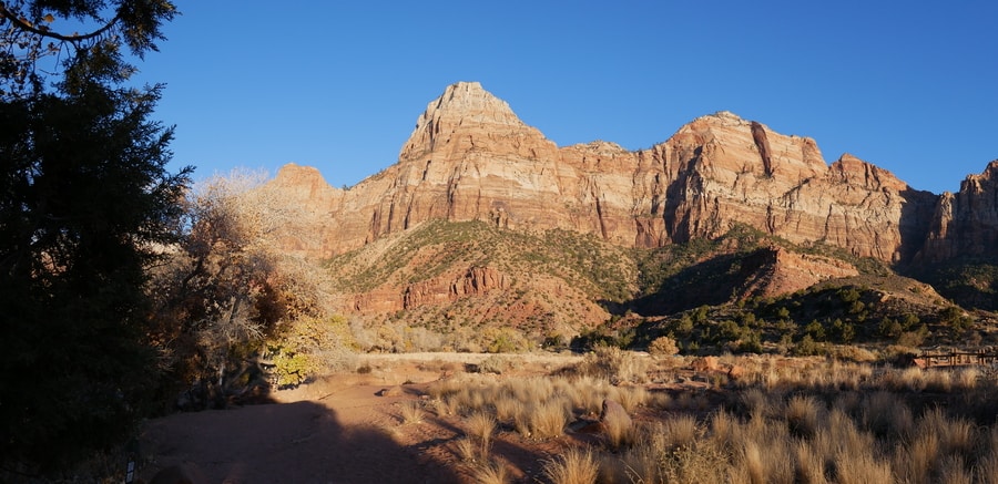
Outside of the park’s boundaries, most Zion tourists choose to stay in Springdale. Top-rated accommodations in Springdale include Flanigan’s Inn and the Red Rock Inn Cottages.
If Springdale doesn’t have available accommodation to suit your fancy, there are also plenty of hotels and Airbnbs in St George (1.5 hours away).
THE ZION SHUTTLE
Zion Canyon Scenic Drive, the park’s main thoroughfare, is restricted to shuttles and hotel guests from roughly mid-March through October. The shuttle service is intended to curb congestion around the canyon’s main trailheads.
There are two free shuttles that service the area. One makes several stops in the town of Springdale, just outside the park’s main entrance. The other runs the length of Zion Canyon and brings visitors to main points of interest.
Long lines form for the latter during summer months and busy weekends.
ZION NATIONAL PARK TOURS
While most people choose to visit Zion national park independently, several guided tours of the area allow you to enjoy the national park from a different perspective.
There are many ways to experience the national park if you’re looking for a bit of adventure—from scenic helicopter flights to Jeep excursions and from guided hikes to Zion UTV tours.
BEST TIME TO VISIT ZION NATIONAL PARK
Between April and September, Zion National Park welcomes soaring temperatures and a whopping 70% of its visitors. As summer approaches, scorching heat can turn even the easiest hikes into grueling slogs. Planning a trip during the park’s off-peak months (October through March) will ensure better weather and fewer panorama-blocking selfie sticks.
In winter months, Zion’s cliffs sometimes get a dusting of snow. While the white contrasts brilliantly against the red rock, trails can become icy and some may even be off-limits.
Come springtime, the park boasts pleasant weather and blooming wildflowers. Spring is a great time to visit Zion, but stay alert: flash floods are always a possibility.
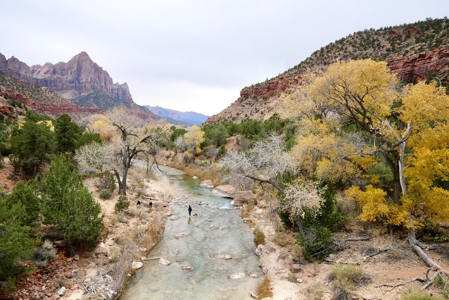
Fall is Zion’s golden season. Literally. Temperatures cool down, the flash flood risk is low, and the trees burst with yellow leaves.
OTHER PLACES TO VISIT NEAR ZION
Zion may be one of the most beautiful destinations in Utah, but it is far from the only place to visit in the state. There are a handful of iconic state and national parks nearby that are worth visiting if you have the time.
Snow Canyon is one of the most beautiful state parks in Utah. It is located less than an hour from Zion National Park. Within an hour, you’ll also find Sand Hollow State Park and Coral Pink Sands.
Many travelers visit Zion as part of a larger national parks road trip around Utah. Bryce Canyon lies less than an hour and a half east of Zion. It is another of Utah’s striking red rock landscapes.
East of Bryce, you’ll encounter Capitol Reef, Arches, Canyonlands, and the immense Grand Staircase-Escalante—home to parts of Utah’s Highway 12 and the Burr Trail Road.
If you head south, you can easily incorporate trips to Antelope Canyon and the Grand Canyon’s north rim.
****
What can I say about Zion that hasn’t already been said a thousand times before? The red rock wonderland is simply epic.
When Mormon settlers came across the spectacular area, they named it ‘Zion,’ which is a Hebrew word meaning sanctuary, or heavenly city.
The name couldn’t be more apt.
For if Zion isn’t a red rock paradise, then I don’t know what is.
Did You Enjoy this Guide to the Top Hikes in Zion? Pin It!
