Visiting the Island in the Sky: Canyonlands National Park
Canyonlands National Park offers some of the most enthralling vistas in the American West. Blanketing more than 520 square miles of the Colorado Plateau, it conceals winding river canyons, towering rock pinnacles, and ancient Native American settlements.
The Colorado and Green rivers are the prime sculptors in the area. Aided by erosion, they have chiseled out a tapestry of gullies and mesas that fans out over the vast desert landscape.
The majority of this immense area remains an obstacle for all but the heartiest back-country explorers.
But in Canyonlands’ Island in the Sky, majestic overlooks provide accessible aerial vistas of the sprawling red rock maze.
ISLAND IN THE SKY DISTRICT
Canyonlands is one of five incredible national parks the that make up Utah’s Mighty 5.
The Colorado and Green rivers form a Y that divides the national park into four separate districts. Each district is independent from the other and contains its own set of must-see attractions.
The Island in the Sky—cradled above the confluence of the Colorado and Green rivers—is the most developed district due to its ease of access.
The island sits atop a sandstone bench called the White Rim. Indeed, white lines trace the contours of the bench’s red earth, as though dusted in flour.
Below the White Rim, sheer walls plunge 1,000 ft to the canyon floor.
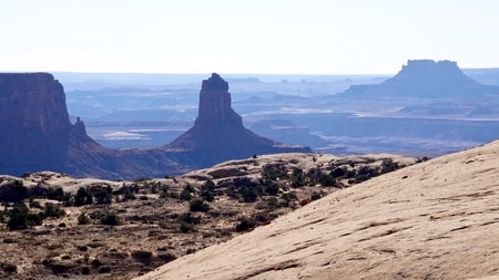
On the horizon, vistas unfold toward the Maze, the Needles, and the distant La Sal and Henry mountains.
The Needles District—while significantly less trafficked than the Island in the Sky—is the other major destination in Canyonlands. It is home to a complex trail network that weaves between red-and-white-striped sandstone columns. Thanks to its comparative isolation and tendency toward 10+ mile trails, it remains relatively off the beaten path.
The Maze and Horseshoe Canyon are remote and seldom visited districts. They require 4×4 vehicles and loads of time.
Due to its proximity to Moab, it is no wonder that the Island in the Sky is the most popular destination within Canyonlands. The spectacular district features vehicle-accessible attractions, iconic landmarks and sweeping views over the fiery desertscape.
ISLAND IN THE SKY VIEWPOINTS
The Island in the Sky boasts breathtaking views over the Colorado and Green rivers. Its roadside pullouts lie along a Y-shaped ribbon of pavement that runs along the entire length of the plateau.
From the national park’s visitor center, the road leads past numerous overlooks and trailheads, toward Grand Viewpoint. At about the halfway mark, a secondary road branches off toward Upheaval Dome.
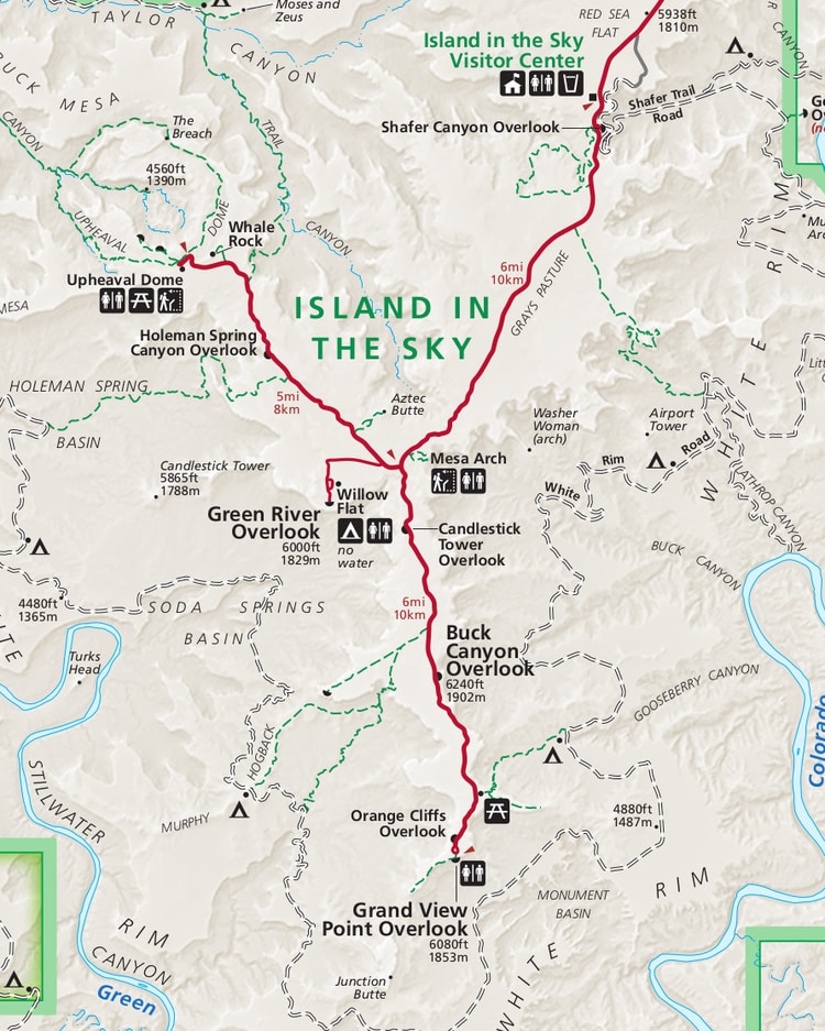
The Island in the Sky’s panoramic points bring visitors face-to-face with the area’s sheer walls and white-tipped cliffs. Every overlook in the district offers a different perspective of Canyonlands’ spectacular landscape.
-
SHAFER CANYON VIEWPOINT
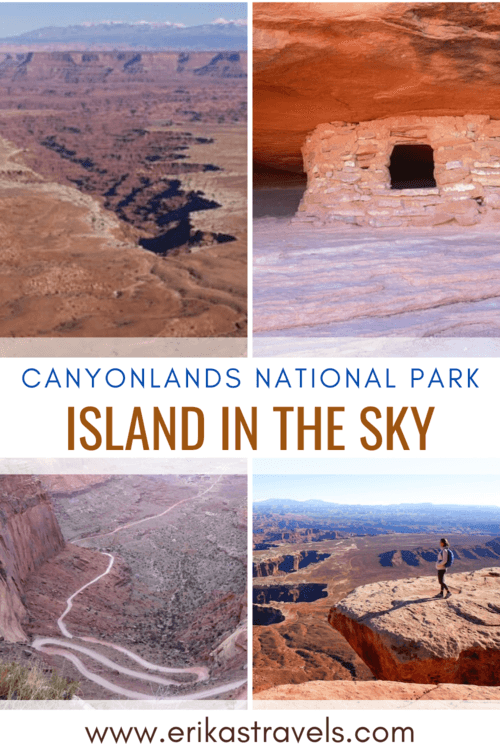
Shafer Road is an 18 mile dirt track located within Canyonlands National Park. Its hairpin turns and precipitous descent are visible from the Shafer Canyon Viewpoint, near Island in the Sky’s entrance gate.
The overlook sits 1400 ft above the canyon floor. Its parking lot marks the beginning of the 5 mile Neck Spring Trail.
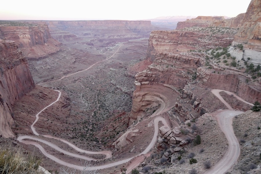
When viewed from above, the winding gravel road reminded me of the Burr Trail in Capitol Reef National Park.
On a future visit to Canyonlands, I’d love to travel its hairpin course and descend onto the White Rim bench for a different perspective of the area.
-
BUCK CANYON OVERLOOK
Buck Canyon Overlook is one of the most iconic viewpoints in Canyonlands’ Island in the Sky. From its aerial vantage point, it showcases a V-shaped ravine that extends toward the island like a protruding finger.
As with many of the park’s attractions, Buck Canyon is easily visible from the parking lot. It is among the park’s most scenic vistas and a fine example of the area’s striking geology.

A dusting of white traces the edges of the canyon rim. This thick salt deposit stands out from the surrounding stone, giving the landscape an ethereal look.
-
GRAND VIEW POINT
Grand View Point lies at the southernmost end of the national park’s scenic drive. From its vantage point, views unfold toward the the Maze, the Needles, and distant La Sal Mountains.
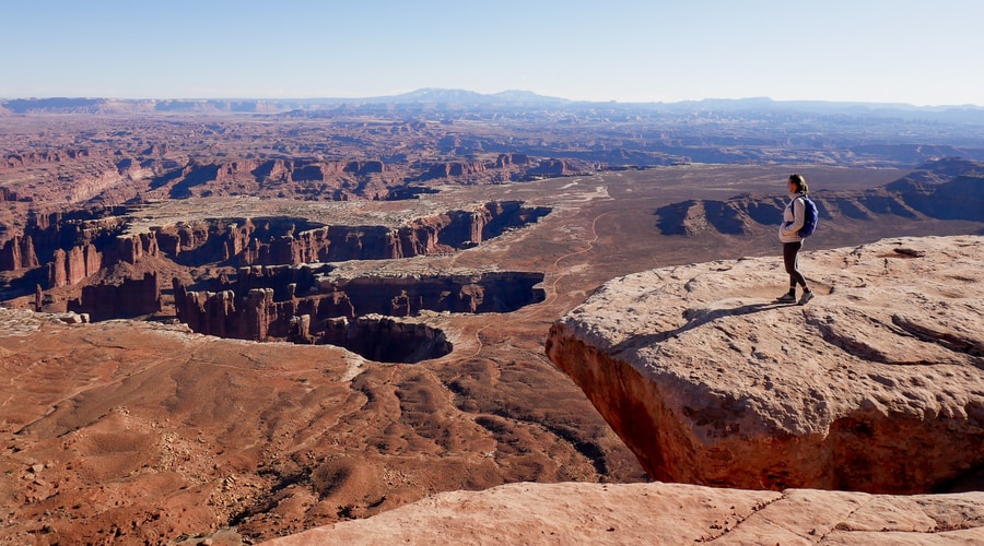
The Grand Viewpoint’s canyon appears like an outstretched handprint, impressed upon the barren red earth. The White Rim Road skirts around its edges.
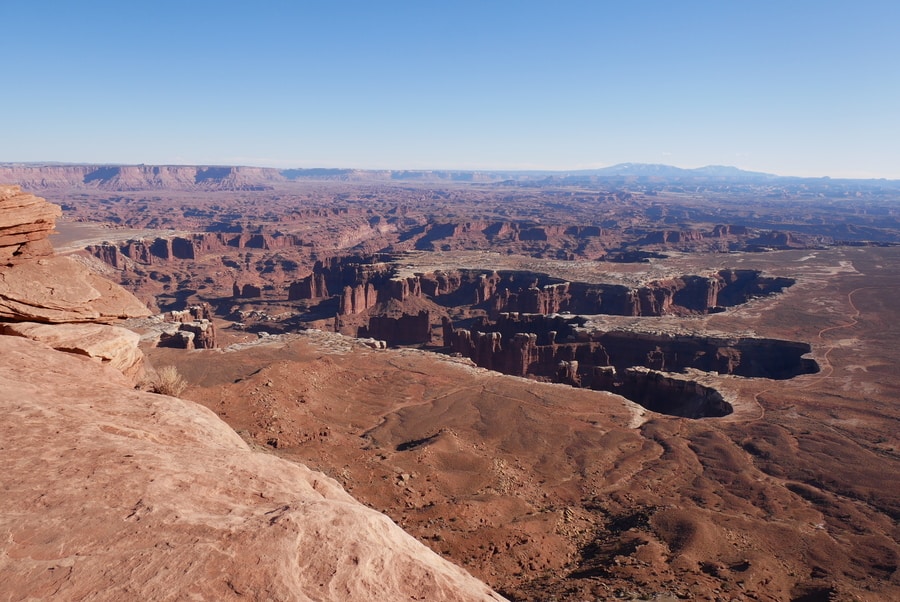
A short hike leaves from Grand View Point and follows the ridgeline to a different vantage point of the area. The crowded trail offers spectacular views of the endless expanse of chiseled rock.
-
GREEN RIVER OVERLOOK
The Green River Overlook lies along Upheaval Dome Road, just beyond the fork in the national park’s main road. It is the first viewpoint en-route to the district’s western end.
The Green River Overlook is one of the only places in which visitors can see the park’s waterways. Below, the transformative work of the river is on full display—creating an endless expanse of canyons.
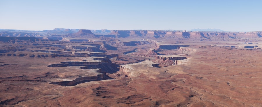
It is truly mind-boggling to imagine how a river so small could have sculpted an area so large.
SHORT HIKES IN CANYONLANDS
Unlike the long meandering trails in the Needles District, the hikes in Canyonlands’ Island in the Sky are all relatively short. They allow visitors to enjoy as much or as little of the park as time permits.
The short hikes in Canyonlands showcase the area’s geological and historical diversity—from natural bridges, to roadside ruins, to birds-eye vantage points.
-
MESA ARCH HIKE
Mesa Arch is one of Canyonlands National Park’s signature vistas. The easy half mile loop trail brings visitors to the spectacular (albeit usually crowded) viewpoint.
The arch sits right at the edge of a cliff that overlooks Buck Canyon. Picturesque keyhole views of the White Rim and La Sal Mountains appear through the arch’s opening.
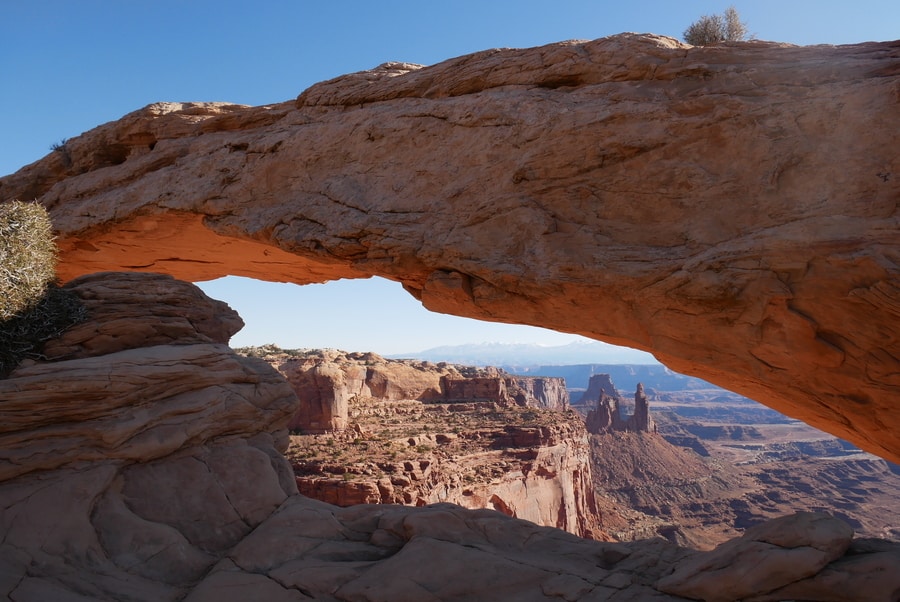
Mesa Arch is particularly epic at sunrise, when the underside of its stone expanse glows a fiery red.
The iconic arch is a must-see Island in the Sky attraction. It is among the most beautiful sandstone bridges in Utah.
-
WHITE RIM OVERLOOK HIKE
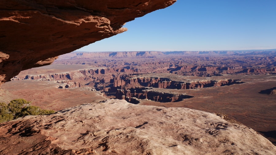
The White Rim Overlook Hike boasts epic views of Canyonlands’ chiseled landscape. Yet, for some reason, we found that the easy 1.8 mile trail was far less crowded than the park’s other attractions.
As the trail to White Rim Overlook makes its way toward the cliff’s edge, views unfold in all directions. To the right, panoramas open up to the Grand View Point’s iconic ravine. To the left, Buck Canyon’s V-shaped tentacle acts as its mirror image.
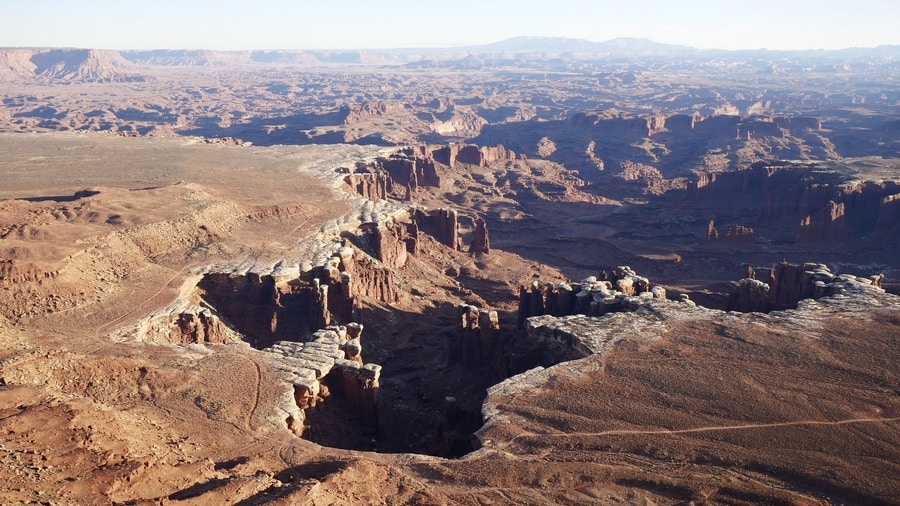
In addition to providing some of the park’s best views, White Rim Overlook also marks the beginning of Gooseberry Trail. The 4.2 mile Gooseberry Trail drops off the side of the mesa and descends into Buck Canyon.
-
AZTEC BUTTE
Aztec Butte Loop is a unique Island in the Sky hike. The 2 mile trail crosses level grasslands and climbs atop a dome-shaped butte that rises above the mesa.
Most people choose to hike Aztec Butte for both its epic views and its Native American relics. Alcoves along the rim of the butte house Puebloan granaries that were once used for storage.
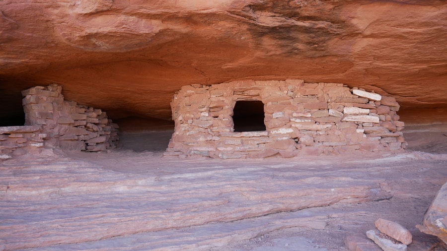
A trail around the top of Aztec Butte visits two crumbling granaries and provides excellent views of Taylor Canyon. A secondary loop around a shorter butte leads to another well-preserved granary.
-
WHALE ROCK
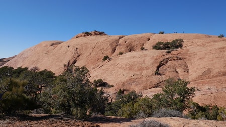
Whale Rock’s long sandstone formation sits along the road, like a beached whale that washed up along the Island in the Sky’s shores.
The one mile hike up Whale Rock makes for a quick detour en-route to Upheaval Dome. It ascends 250 feet and provides aerial views over the surrounding canyons.
The easy path is suitable for families and novice hikers. Cairns mark the path as it makes its way up the sandstone slickrock.
-
UPHEAVAL DOME
Upheaval Dome lies at the westernmost end of Island in the Sky. A tan dome amidst rust-colored rock, it is the most puzzling geological feature within Canyonlands National Park. Geologists have two competing theories for what created Upheaval Dome. An illustrated panel at the overlook describes both hypotheses.
The salt dome theory suggests that sediment piled onto an underlying salt layer and hardened into sandstone. The heavy rock pushed down on the salt, creating uneven pressure that led to a budge in the salt layer.
The other school of thought suggests that a meteor crash-landed in the area 60 million years ago. The crater it left behind was unstable. Some parts of it collapsed, while other spaces filled with rock and salt.
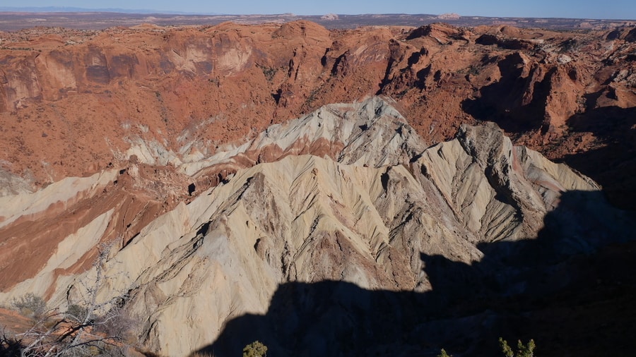
A 1.7 mile trail from the parking area showcases two different viewpoints over the peculiar landform.
LONGER HIKES: ISLAND IN THE SKY
Like Bryce Canyon National Park, the Island in the Sky is best known for its viewpoints and short hikes. The area’s most beloved panoramic points are all easily accessible from the park’s main road.
However, longer treks still exist within the Island in the Sky. For travelers looking to stretch their legs and descend below the canyon rim, the Syncline Loop and Gooseberry Hike are popular options.
Additional trails connect the national park’s main road with the White Rim Road.
THE WHITE RIM ROAD
I’ve heard fantastic things about the White Rim Road in Canyonlands. But with only one day in the park, I was unfortunately not able to undertake the 2-3 day drive.
The White Rim Road loops around the Island in the Sky District. Featuring lonely viewpoints, rutted roads and plentiful spur trails, it is said to be one of the top adventures in Canyonlands.
DEAD HORSE POINT STATE PARK
Dead Horse Point State Park is not part of Canyonlands’ Island in the Sky District. However, due to its close proximity and similar topography, many choose to incorporate it into their national park itineraries.
The U-shaped canyon is one of the most beautiful state parks in Utah and an iconic southwest attraction. The park got its name from local legend. According to folklore, cowboys once used the land as a natural corral for wild mustangs. In the inhospitable and rugged terrain, the horses often died of thirst and exposure.

Visitors to the Island in the Sky would be remiss to skip over the awe-inspiring views from Dead Horse Point.
Try to visit at sunrise, when the sun’s rays paint the canyon walls in fiery shades of red and pink.
WHERE TO STAY NEAR ISLAND IN THE SKY
Since Canyonlands National Park does not have any lodging within its confines, camping is the only option for travelers looking to stay close by. The Willow Flat Campground has 12 first-come first-served spots and is open year-round. Nearby, Dead Horse Point State Park contains two additional established camping areas.
Due to the dearth of lodging options near the park, most Canyonlands visitors will likely choose to stay half an hour away, in Moab.
Centrally located between Arches National Park and the Island in the Sky, Moab is southeast Utah’s premier tourism hub. As a gateway to the region’s attractions, Moab has a long list of fantastic places to stay. These places suit a wide array of travel styles and budgetary constraints—from backpacker hostels to luxury resorts.
Top rated hotels in Moab include the Castle Valley Inn and Sunflower Hill Inn.
****
Canyonlands often doesn’t receive the credit it deserves. For most travelers to Moab, the vast and disjointed national park plays second fiddle to Arches.
The national park is so sprawling and dispersed that it would take months to visit entirely. Its sections lie scattered about an area of red rock that is half the size of Rhode Island.
Due to its inaccessibility and long distances, only the most daring explorers make their way into Canyonlands’ interior.
Luckily, for everyone else, the Island in the Sky provides a perfect vantage point from which to view the formidable landscape.
______________________________________
Did You Enjoy this Guide to the Island in the Sky in Canyonlands National Park? Pin It!
