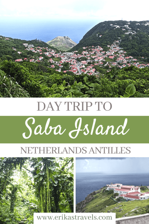
Saba Island Travel: The Caribbean’s Unspoiled Queen
Saba isn’t your typical Caribbean destination.
The island contains no beaches. Nor is it home to casinos, yacht clubs or high-rise resorts. Covering an area of only thirteen square kilometers and home to only one road (aptly named “The Road”), Saba is little more than an out-of-place fleck on the Caribbean map.
Yet those who visit the jungle-clad island, will find a place that is charming, safe, stunning and wholly authentic.
To the eclectic mix of locals and expats that call Saba home, the island is a little utopia. A garden of Eden. And a quiet refuge from the constant stressors of modern life
Saba Island: An Overview
Saba Island sits between Sint Eustatius and Saint Martin, in the Caribbean’s Leeward Islands.
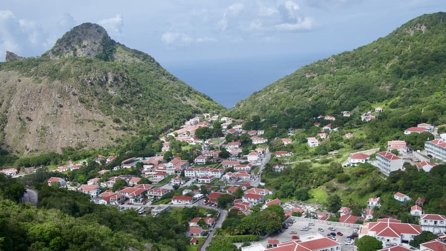
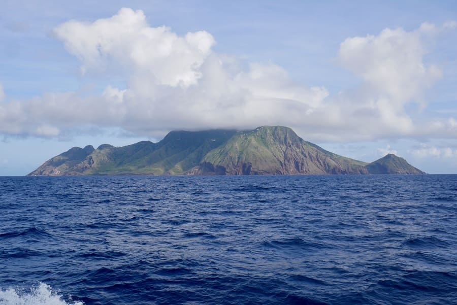
A special municipality of the The Netherlands, tiny Saba is as mountainous as its motherland is flat. Known as the “Unspoiled Queen” of the Caribbean, Saba draws adventure travelers with its dramatic landscapes and coral gardens. It boasts pristine rainforests, world-class diving, and hiking trails that showcase jaw-dropping views.
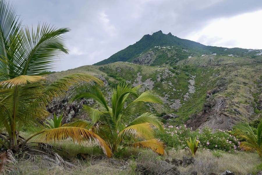
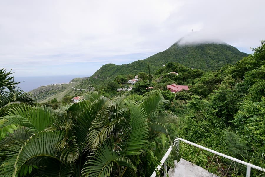
Much like Saint Lucia, Saba is characterized by its lush green scenery and its volcanic landscape. Dense rainforest drapes the island’s peaks, while traditional gingerbread-style houses sit cradled in its valleys. The forest that crowns the mountain’s summit resembles the cloud forest in Monteverde and is home to a remarkable array of plants and flowers.
A Brief History of Saba
Historically home to the Ciboney and Arawak peoples, Saba was first sighted by Christopher Columbus in 1493 during his second voyage to the Americas. Deterred by the island’s rocky shores, Colombus never set foot on Saba.
The first recorded visitors from Europe arrived in 1632, when a group of shipwrecked English sailors landed on the island. A decade later, in the 1640s, the Dutch governor of nearby Sint Eustatius sent several Dutch families to settle on the island on behalf of the Dutch West India Company.
Ultimately, the Netherlands solidified its control over Saba in 1816. The island, together with Sint Eustatius, Saint Maarten, Aruba, Curaçao and Bonaire, became part of the Netherlands Antilles.
In October 2010, the Netherlands Antilles dissolved.
The island has since been declared a special municipality of the Netherlands.
Saba’s Geography
Standing at 2,954ft above sea level, Mount Scenery dominates the island of Saba.
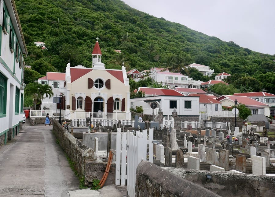
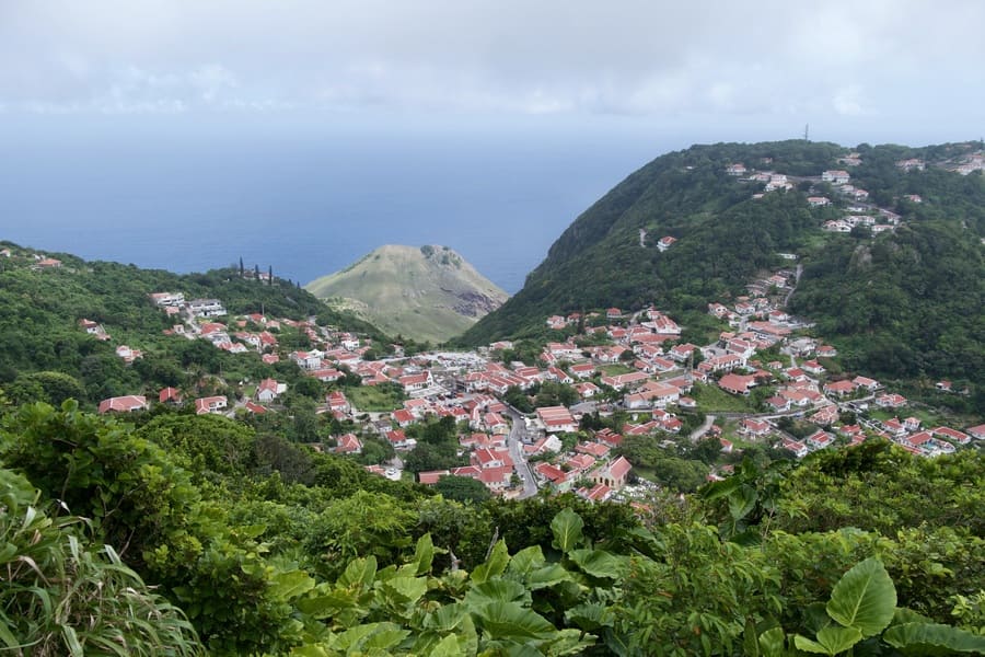
The dormant volcano is the main feature on the island. Saba’s four small towns—The Bottom, Hell’s Gate, St John’s and Windwardside—lie wedged between the few valleys on Mount Scenery’s flanks.
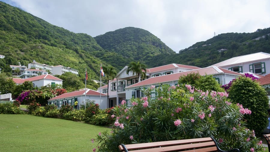
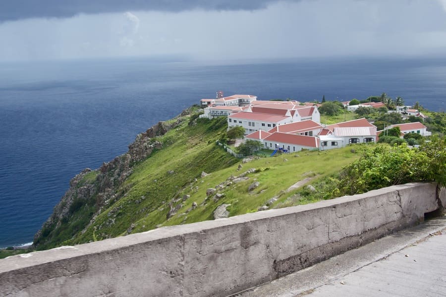
The Bottom, Saba’s capital, sits uphill from the port and contains the island’s administrative offices and government buildings.
Windwardside, perched higher on the slopes of Mount Scenery, is a charming tourism hub known for its quaint shops, cozy restaurants, and access to hiking trails.
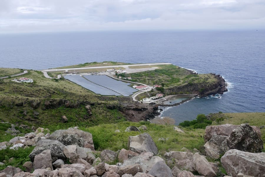
Hell’s Gate, also known as Zion’s Hill, consists of a smattering of houses on the slopes of Mount Scenery, above the airport.
And St. Johns, home to the island’s primary school, is a quiet residential village set against a cobalt ocean backdrop.
A singular road connects Saba’s port, its four towns, and its airstrip. The Road on Saba is one of the island’s most remarkable achievements, often described as an engineering marvel. Before its construction, many people thought that building a road on Saba’s steep, rugged terrain would be impossible.
But in the 1930s, a local man named Josephus Lambert Hassell, designed and led the effort to build a road by hand across the island, despite a lack of formal engineering training.
The Road remains Saba’s only paved artery. If you want to stray away from it, you’ll have to rely on the island’s vast network of hiking trails.
A Hiker’s Paradise
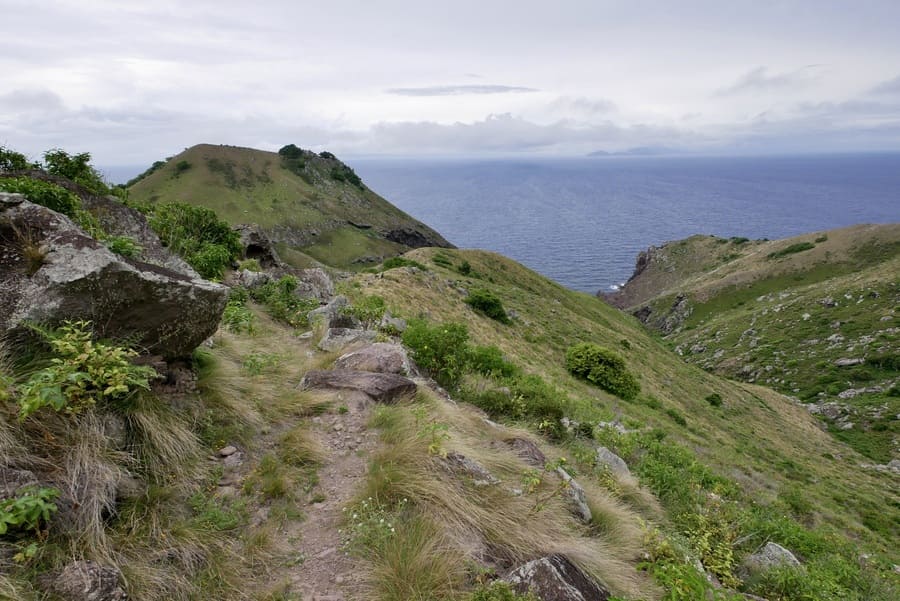
All around Saba, an extensive web of hiking trails offers breathtaking views of Saint Kitts, Saint Eustatius and the surrounding sea.
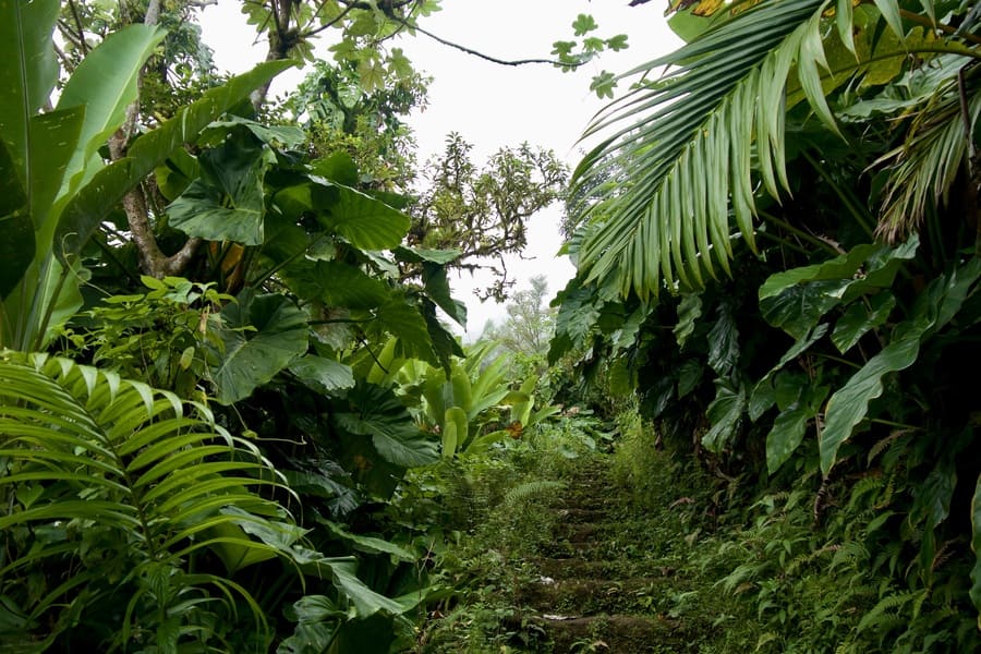
Hiking in Saba is a rewarding experience, as the island’s well-maintained trails wind through lush rainforests and along stunning coastline.
The island’s most famous hike leads to the summit of Mount Scenery.
Other popular trails include Sandy Cruz, Mas’Cohones, and Spring Bay. These hiking paths showcase diverse flora, dramatic ocean views, and historic paths once used by locals before the construction of “the Road.”
Mount Scenery Trail
The Mount Scenery Trail is Saba’s most popular hiking destination.
I’ve hiked to the top of Mount Scenery twice: the first time on my solo day trip to Saba from Saint Martin, and the second time with Dan and Elio.
The Mount Scenery Trail has several access points, offering hikers different routes to the summit. The most popular and most direct starts near the Trail Shop in Windwardside, where stone steps lead to the summit through lush rainforest. The hike follows a strenuous out-and-back trail, which goes up 1064 steps to Mount Scenery’s 2,910 ft summit and back.
Another access point is from the Bottom Mountain trailhead, which eventually connects to the Mount Scenery route. A third begins at the Sandy Cruz trailhead and connect with the Mount Scenery path from the northwest side.
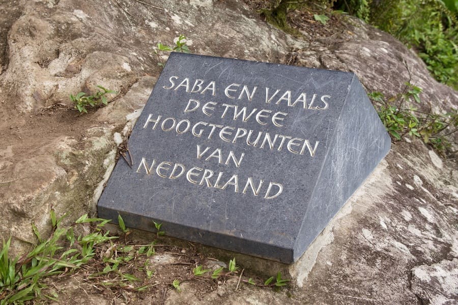
At Mount Scenery’s summit, you’ll find a plaque marking the tallest point in the Netherlands and—if you’re lucky—views of the surrounding islands.
The Mount Scenery hike is tough, with few switchbacks or stretches of level ground. I could feel the burn in my legs as I conquered the precipitous climb.
Despite the fact that climbing Mount Scenery is one of the most popular things to do on Saba, you’re unlikely to see other hikers. The only sounds I encountered during the climb were thud of my heavy footsteps, the rustling of the leaves and the chirping of birds.
The top of Mount Scenery is often encircled by clouds that obstruct the surrounding views.
Unfortunately, neither of my hikes were an exception.
Mas’Cahones
The Mas’Cahones Trail begins at the Mount Scenery trailhead and veers off to a spectacular lookout on Maskehorne Hill.
The trail is less than a mile long, with 360ft of elevation gain. It offers a wonderful effort-to-reward ratio and the island’s best aerial views of Windwardside.
Since the Mas’Cahones hike mostly stays below the cloud forest, it is a great option for overcast days.
Sandy Cruz Trail
The Sandy Cruz Trail begins in Upper Hell’s Gate and traverses the rugged northern side of the island.
About a quarter of the way in, the path forks. One trail continues toward Castle Hill, while an offshoot connects to the Mount Scenery summit.
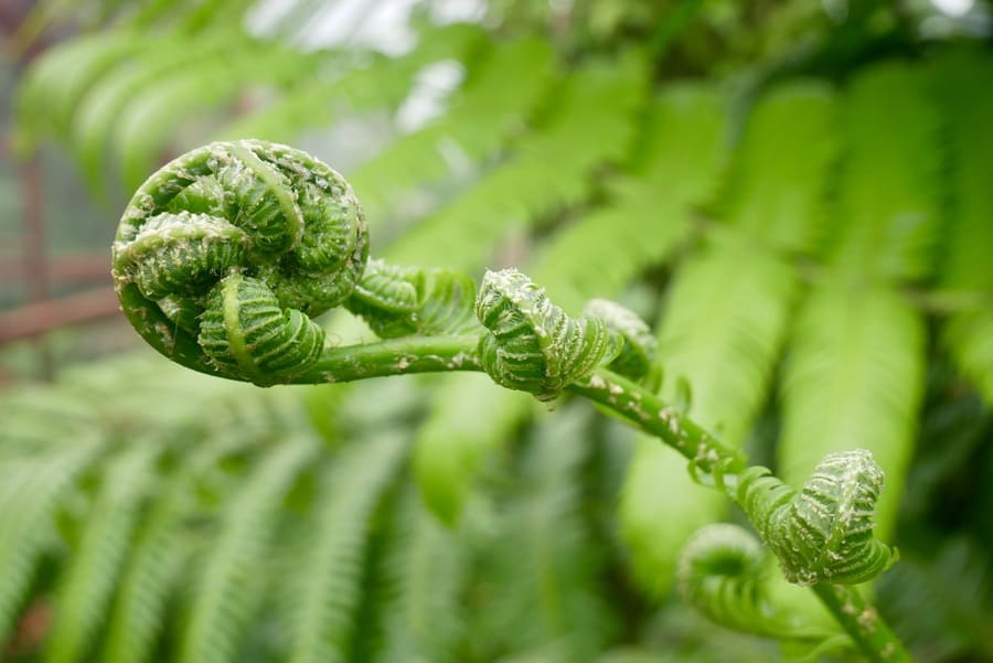
Sandy Cruz is one of the most popular island hikes, though it remains largely untrodden. The path winds through dense cloud forest, with towering mahogany trees, hanging vines, and massive ferns. Along the way, weather permitting, the path showcase views of the Caribbean Sea and surrounding cliffs.
Though the trail is well-marked, it can be challenging in portions, with uneven terrain and overgrown vines.
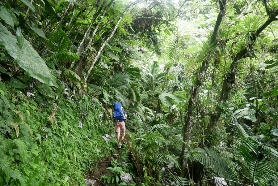
We hiked a portion of the trail after a rain shower and found ourselves getting repeatedly stuck in ankle-deep mud.
Poor weather meant that we didn’t get to see ocean views, but we still enjoyed the feeling of being completely swallowed by the island’s lush greenery.
The Elfin Forest Trail
As its name suggests, the Elfin Forest Trail leads through a densely vegetated mist-shrouded wonderland that looks straight out of a fairytale.
The forest’s existence is due to the unique combination of elevation and moisture that creates a microclimate unlike anywhere else on the island.
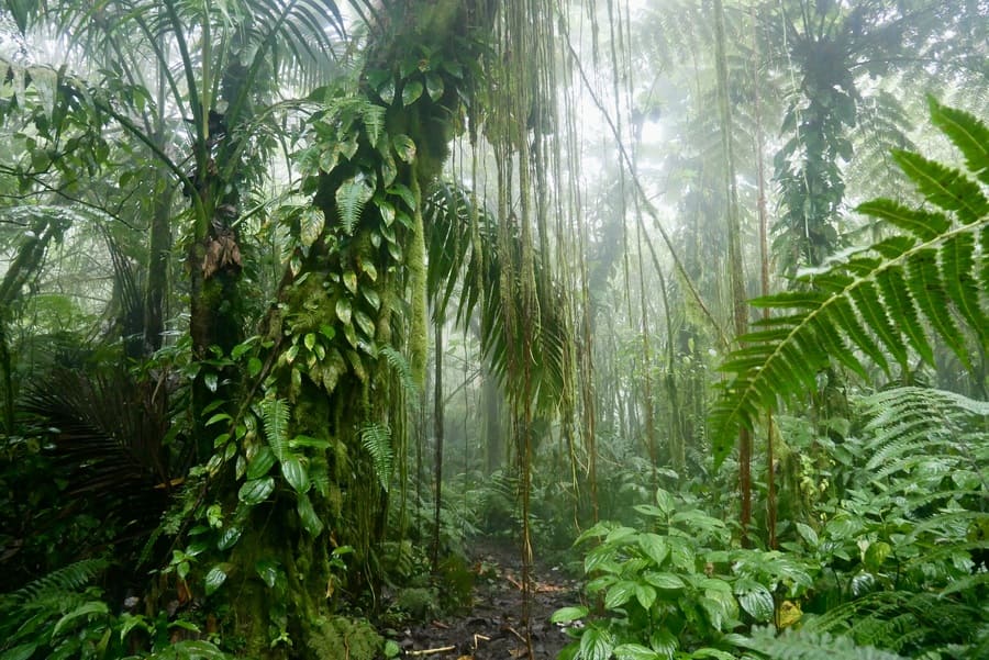
The Elfin Forest Trail connects Sandy Cruz with the Mount Scenery summit. You won’t pass through the Elfin Forest if you take the traditional route up Mount Scenery from Windwardside.
As with Sandy Cruz, we found the path through the Elfin Forest to be incredibly muddy and somewhat treacherous.
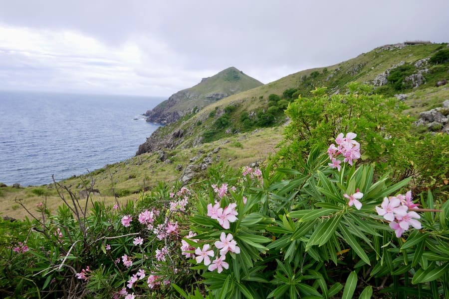
Spring Bay Trail
Hiking the Spring Bay Trail is my favorite Saba activity.
This moderately challenging trail begins at English Quarter near Windwardside and ends at Kelby’s Ridge near the airport. It winds its way through lush tropical vegetation, past old stone walls, and along sheep grazing lands.
While it starts under a canopy of trees, the majority of the Spring Bay Trail cuts through dry forest and scrub vegetation. Occasional trees gives shade to wandering goats and tiny flowers and cacti line the path.
The trail is hot and exposed, so it is the perfect place to hike when Mount Scenery is covered in clouds. The hike takes around 2-3 hours one way. You can plan on hitchhiking or booking a cab in advance for the return trip.
We did not run into anyone else during our hike to Spring Bay.
We truly felt like we had the entire stretch of seldom-trodden coastline to ourselves.
The Tidepools
Accessible via the half-mile-long path near the airport, the Saba Tidepools are a rugged and beautiful place to visit. Formed by a large lava flow that cascaded down the northeast side of the island into the ocean some 5,000 years ago, these aquamarine pools sit nestled amidst jagged rock formations.
Inside the pools, you’ll find urchins and other small forms of sea life.
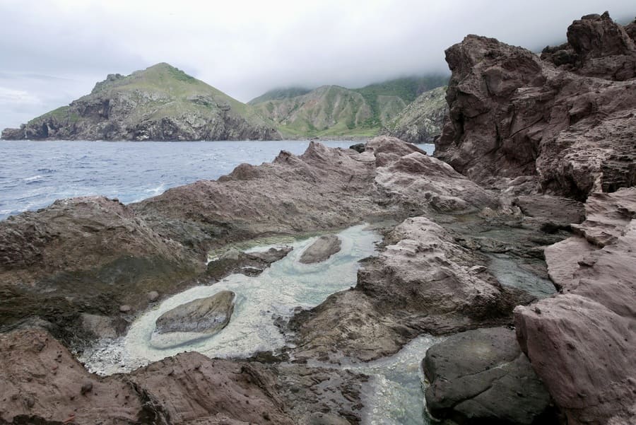
Once we reached the end of the short trail, we scrambled over rocks and took a look around. The views of Saba’s green-carpeted cliffs and cobalt sea were simply breathtaking. With their backdrop of crashing waves, the Saba Tidepools reminded us of the Queen’s Baths on Eleuthera Island.
Saba Marine Park
Saba is one of the best scuba-diving destinations in the Caribbean.
Most diving adventures in Saba start at Fort Bay. The two main dive operators— Sea Saba Dive Center and Saba Divers—offer guided tours, equipment rentals, and PADI certification courses.
Dan and I would have loved to witness the UNESCO-recognized kingdom of colorful coral and fish, but the impracticality of bringing a toddler along on a snorkeling or diving trip convinced us to enjoy Saba from above sea-level instead.
Where to Stay in Saba
The island of Saba has limited accommodation options due to its size.
You won’t find any luxury resorts on the island, nor will you find much in the way of internationally-recognized hotel chains.
We stayed at El Momo Cottages in Windwardside while on Saba. The cottages were one of only two options that we had available to book last minute on booking.com (the other being the larger Saba Arawak Hotel).
If you’re traveling on a budget, the cottages are probably your best bet. They offer price-conscious no-frills accommodation, a pool, and drop-dead views of Saba’s rugged landscape.
The Saba Arawak Hotel, also in Windwardside, has an outdoor swimming pool and parking available.
If you’re looking for a boutique hotel experience, Juliana’s Hotel offers what is probably the best accommodation in Saba. The rooms are a bit pricier, but they are also clean and comfortable and centrally-located.
The restaurant onsite, Tropics Cafe, is a wonderful place to eat regardless of whether you are staying at Juliana’s.
Getting to Saba
Though there are no direct flights between Saba and the United States, you can reach the island by plane from St Martin or by boat from a number of the surrounding islands.
-
By Air
Getting to Saba by air is an adventure in and of itself. The island’s tiny airstrip—the shortest in the world—welcomes flights from Saint Maarten multiple times a day.
Winair operates all commercial flights to Saba. You can also charter flights with SXM Airways or Windward Air.
Flying to Saba can be pricy, but the hair-raising 12 minute flight is an aviation enthusiast’s dream.
-
By Ferry
Scheduled ferries connect Saba with Saint Martin and Sint Eustatius. These ferries operate throughout the week and are the preferred option for budget travelers. The trip takes 90 minutes each way.
The “Edge” high-speed ferry makes the trip from Saint Martin to Saba two times a week (Tuesday and Friday). It departs from the Simpson Bay Resort and arrives at Saba’s main port.
The ferry leaves Saint Martin at 9:00am and returns from Saba at 3:30, making a day trip possible.
Alternatively, Makana Ferry Services travels between Sint Eustatius, Saint Martin, Saint Kitts and Saba.
It connects Saba with Saint Martin five days a week, with Sint Eustatius six days a week, and with Saint Kitts twice a week. You can find ferry times, prices, and dates on the Makana Ferry website.
Day Trip to Saba Island
I visited Saba with Aqua Mania Adventures as a day trip from Saint Martin. The return trip takes about three hours and affords day-trippers the opportunity to explore Saba on their own for the better part of five hours.
Though I enjoyed my day trip to Saba from St Maarten, I believe the island deserves at least two days.
When to Visit Saba Island
Saba is a tropical destination that has warm weather year-round. High season on the island runs between mid-December and mid-April.
During peak months, you’re likely to encounter weather that is warm, sunny, and dry.
During the months of August-October, the weather in Saba is hot and muggy. Visiting during this time also increases the risk of encountering a tropical storm.
****
Saba is a remote escape that, while well-equipped for tourists, has little in common with its Caribbean neighbors.
Saba is rustic, rugged and off-the-beaten path. If you are looking for the Caribbean staples–fancy resorts, buzzing nightclubs and pristine beaches–you may want to head to nearby St Barths or Anguilla instead.
Yet, if you are a lover of the outdoors, of lush and tropical scenery, of incredible views and of places that ooze with originality and authenticity, then Saba is sure to deliver.
________________________________
Did You Enjoy This Guide to Visiting Saba? Pin It!