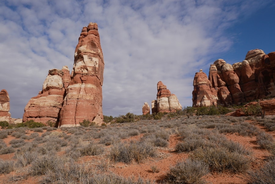
Hiking in the Canyonlands Needles District
Canyonlands National Park is a rugged wilderness of buttes and mesas that sprawls outward in a tapestry of oranges and reds.
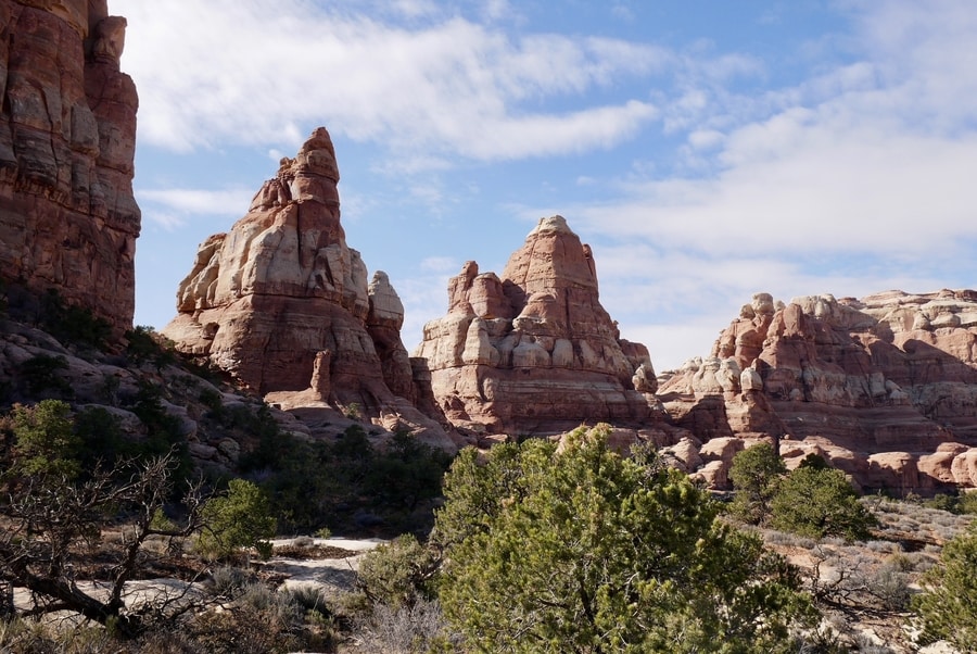
The Canyonlands Needles District is one of four distinct areas within the national park. It is an oft-forgotten wonderland of stone pillars that jut skyward like blunted needles. Among the area’s towering rock garden, it conceals some of the best hiking trails in the American Southwest.
Although it isn’t as heavily trafficked as other areas in Utah’s Mighty 5, the hiker’s paradise boasts bewitching vistas, diverse topography, and unforgettable trails.
VISITING CANYONLANDS: THE NEEDLES
Showcasing 527 square miles of southern Utah’s most dramatic desert scenery, Canyonlands National Park is as varied as it is vast. Sheer canyon walls loom above the Colorado and Green Rivers, their serpentine waters snaking 1000ft below white-tipped cliffs. Above their fold, stone spires erupt from the desert floor.
The sprawling maze of chiseled rock consists of four districts that are separated by hours of driving: the Island in the Sky, the Maze, Horseshoe Canyon, and the Needles.
Each area of the park is striking in its own way.
Yet, when it comes to accessibility, they differ vastly.
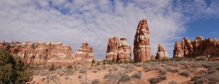
The Island in the Sky is by far the most popular destination within Canyonlands National Park. Located near Moab, the district features vehicle-accessible viewpoints and iconic landmarks.
The Maze and Horseshoe Canyon—on the complete opposite spectrum—are remote and seldom visited. They require 4×4 vehicles and loads of time.
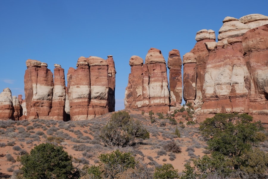
The Canyonlands Needles is somewhat of a happy medium. Home to a vast network of trails that weave between 100-plus-foot-tall red-and-white-striped sandstone columns, the district is arguably the park’s best hiking destination. Thanks to its comparative isolation and lack of roadside attractions, it is also relatively off the beaten path.
THE NEEDLES SCENIC DRIVE
While Island in the Sky is chock-full of roadside pullouts and short walking paths, the Canyonlands Needles District reserves its most dramatic scenery for those willing to put in extra effort.
At just over six miles long, the scenic drive in the Needles is quite short in comparison to that of Utah’s other national parks.
Still, for travelers with limited time or desire to hike, it offers the opportunity to look out over the area’s natural arches and pinnacles.
Popular stops along the short paved road include the Wooden Shoe Viewpoint, Pothole Point, and Roadside Ruin.
CANYONLANDS HIKES: THE NEEDLES DISTRICT
Though it has a few roadside viewpoints, the Needles District is not the type of place that can easily be explored from behind a vehicle dashboard. Its awe-inspiring attractions lie scattered about the desert floor. To reach them, one must tackle the area’s complex network of hiking trails and rutted 4 wheel drive roads.
While the Canyonlands Needles contain more miles of hiking trails than we could possibly squeeze into a single day, Dan and I did our best to soak in the area’s most impressive views with limited time.
At the advice of a park ranger, we focused on the Chesler Park Loop. The popular-yet-lightly-trafficked 11 mile loop begins at the Elephant Hill Trailhead. It includes the Chesler Park Trail and Joint Trail.
After making our way through the Joint Trail, Dan and I opted to tack on a detour. We still had some energy and daylight to spare, so we made our way to Druid Arch—one of the most spectacular landmarks in the Needles District.
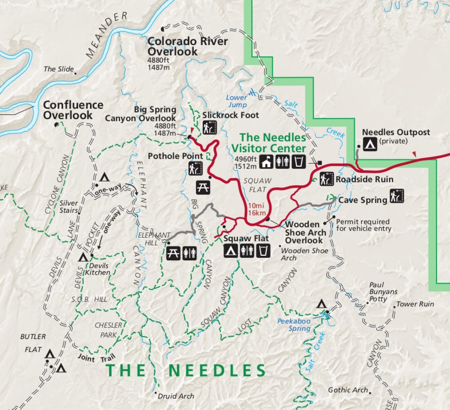
In total, our hike consisted of approximately 16 miles over rolling elevation. It encompassed three of the best hiking trails in the Canyonlands Needles.
The pieced-together loop ranks among the best hikes I’ve ever completed.
-
CHESLER PARK
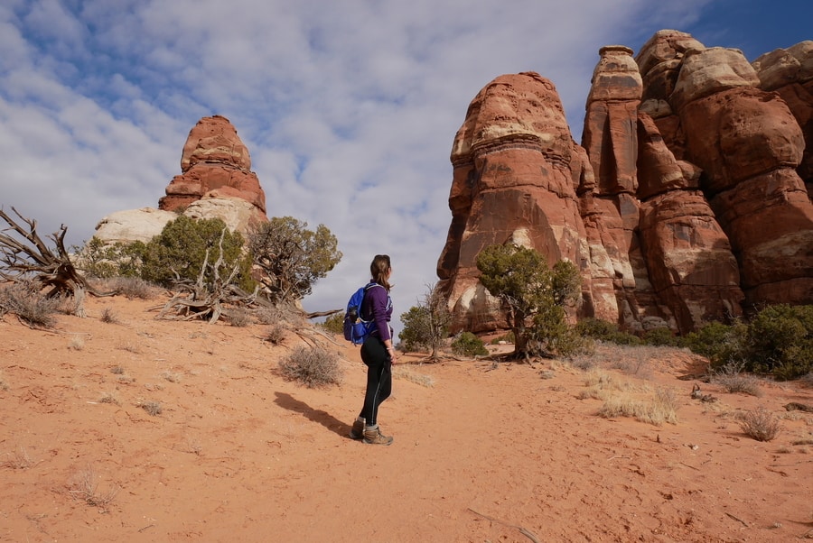
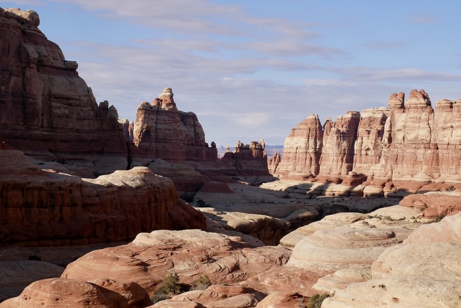
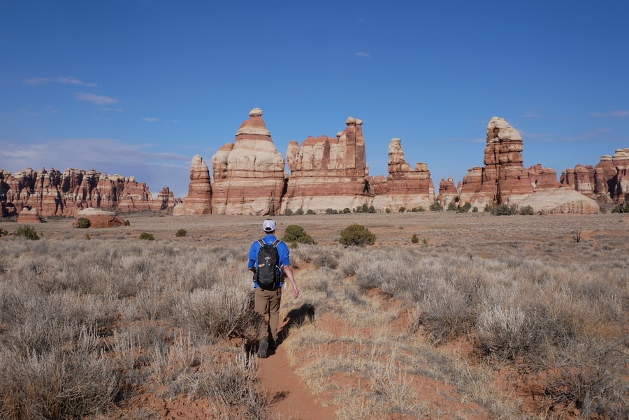
The Chesler Park Loop provides the best up-close views of Canyonlands’ Needles District. The trail climbs between sandstone fins and mushrooms that looks straight out of a Dr Seuss novel. The 11-mile loop feels mostly flat, but packs in 1,200 feet of rolling ups and downs throughout the day.
Leaving the Elephant Hill trailhead, Chesler Loop winds in and out of canyons and squeezes between towering pillars. It passes pothole-speckled rock slabs and living cryptobiotic soil—climbing to Chesler Park through a dramatic gap in the wall of needles.
At the Needles Overlook, 360 degree panoramas span out in all directions.
Beyond, views open up toward the Maze and reveal the 10,000-foot-tall La Sal Mountains on the horizon.
From Chesler Park, hikers can either turn back toward the Elephant Hill Trailhead, or continue the scenic loop along the Joint Trail. The 5.4 mile out and back trail to Chesler Park is a must-see on its own.
But when combined with the Joint Trail, it is truly among Utah’s top echelon of hikes.
-
THE JOINT TRAIL
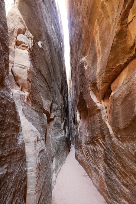
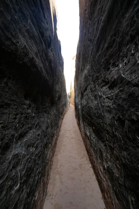
From the Chesler Park gardens, the sandy hiking path drops into a gap between boulders and seemingly disappears into a narrow ravine. The two mile section beyond Chesler Park is known as the Joint Trail. Along its most popular quarter-mile stretch, it follows a surreal slot between soaring rocks.
As the trail travels through the rock fracture, its walls seem to stretch higher and higher. The pathway reveals a hallway that is up to 40 ft tall and—in some spots—only three feet wide.
There are a few areas along the Joint Trail that involve climbing over ladders, but the path is otherwise quite level.
-
DRUID ARCH TRAIL
The trail to Druid Arch is among the most spectacular hikes in the Needles. It follows the first part of the Chesler Park Loop, then branches off toward Elephant Canyon. As an out-and-back, the path is just shy of a dozen miles. When added to the full Chesler Park and Joint Trail Loop, it clocks in at around 16.
Since we had the time and energy to continue our walk after reaching Chesler Park, Dan and I decided to tack on a visit to the impressive landmark.
The angular arch—with its elongated openings—rivals the crescent-shape spans found in Arches National Park. It is among the most iconic attractions in the Canyonlands Needles.
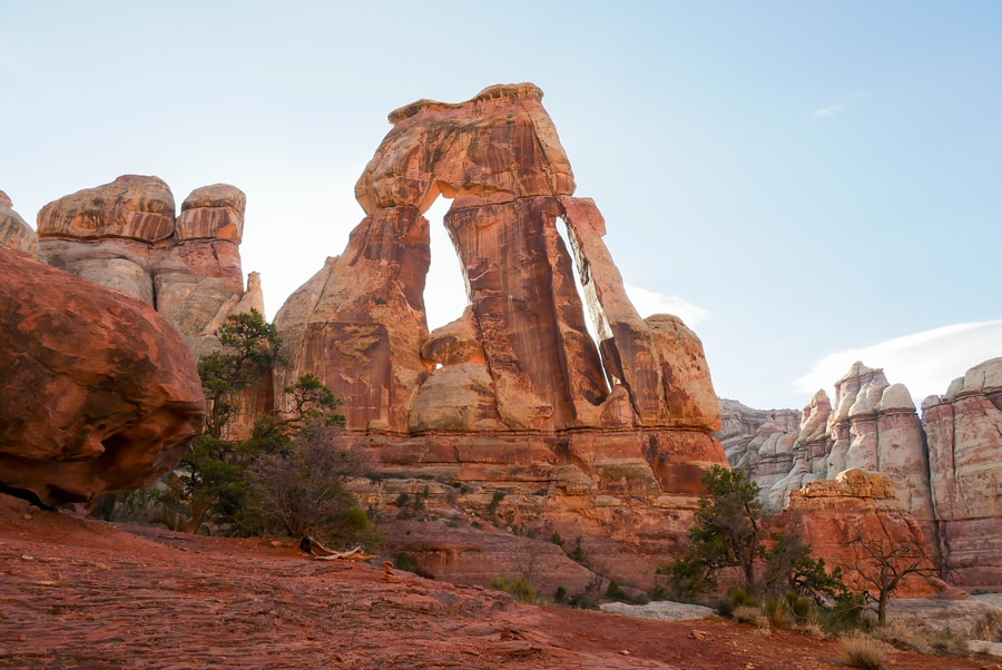
For much of the hike, the trail to Druid Arch travels along Elephant Canyon’s sandy wash.
As the trail ascends up the dry river bed, its multi-hued sandstone walls—topped by spires, knobs and fins—grow in stature and become more impressive by the mile.
The final quarter mile of trail requires hikers to scale a ladder and then scramble up a steep boulder-choked ravine. Upon reaching the sandstone bench at the top of the ravine, fantastic views unfold over Druid Arch and Elephant Canyon.
The pieced-together loop took us almost the entire day to complete. Over the course of 16 miles, it brought us face-to-face with the Needles District’s most impressive landscapes.
Visiting Druid Arch added five miles to an already long and strenuous hike, but the reward was unequivocally worth the consequent soreness in our feet.
GETTING TO THE NEEDLES
The Needles District of Canyonlands lies near the town of Monticello, about an hour and a half south of Moab.
The scenic drive passes by an unnamed roadside arch and then splits from Highway 191, entering a vast area of buttes and mesas.
Newspaper Rock is located 15 miles west of the highway, along the Indian Creek Corridor Scenic Byway. It makes for a quick and memorable detour en-route to the Needles.
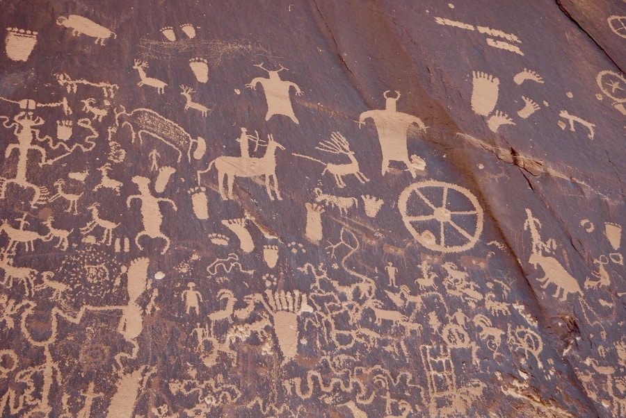
More than 650 rock art designs—include depictions of animals, human figures, and hunting symbols. It is one of the most impressive collections of petroglyphs in the United States and reminded me of Atlatl Rock in Valley of Fire (albeit far more densely packed with doodles).
Beyond Newspaper Rock, the road leading to the Needles Visitor Center traverses a series of rugged canyons that are defined by their warm-hued walls.
After visiting, I learned that the epic scenery leading up to the Needles is part of the Bears Ears National Monument.
WHERE TO STAY NEAR THE CANYONLANDS NEEDLES
Since Canyonlands National Park does not have any lodging within its confines, camping is the only option for travelers looking to stay in the park. The Needles Campground has 26 designated spaces and costs $20 per night.
For hikers seeking solitude amidst the rock spires, Canyonlands has an extensive backcountry.
Additionally, BLM lands around the park allow for free dispersed camping.
If camping doesn’t sound appealing, there are plenty of places to stay about an hour away. Lodging can be found in Monticello or Moab —with Moab being much larger and Monticello being closer.
In Monticello, the Farmhouse Cabin boasts rave reviews. In Moab, accommodation options range from backpacker hostels to luxury resorts. Top rated hotels in Moab include the Castle Valley Inn and Sunflower Hill Inn.
Keep in mind that Moab is nearly an hour and a half away from the Needles Visitor Center.
WHEN TO VISIT THE CANYONLANDS NEEDLES
As with many destinations in the American Southwest, the Canyonlands Needles District is best to visit in spring and fall. During the shoulder months, temperatures are moderate throughout the day and remain manageable after sundown.
In summer months, Canyonlands can get oppressively hot, with daytime highs soaring in the 100s. In winter, freezing temperatures can make camping uncomfortably cold.
Dan and I hiked the Needles in early December. We found the daytime weather to be perfect for hiking.
*****
When compared to the delicate sandstone hoodoos of Bryce or the dramatic cliffs of Zion, Canyonlands’ rugged scenery receives little attention. And the attention it does receive, mostly revolves around the Island in the Sky.
But Canyonlands is so much more than its (justifiably famous) image of Mesa Arch.
In the Needles District, the dramatic scenery rivals some of the most striking landscapes in Utah’s collection of state and national parks.
The area is vast, aesthetically beautiful, and blissfully crowd-free.
For travelers willing to strap on their hiking boots, the rewards of exploring the Needles are as endless as the scenery.
____________________________________________
DID YOU ENJOY THIS GUIDE TO THE CANYONLANDS NEEDLES? PIN IT!
